Tignes · Tignes–Val d'Isère ski area
Tignes ski map: the ski area, as a local sees it
The full Tignes ski map in HD, ready for your pocket and your phone. Below it, what we've learned taking skiers round Tignes since 2001: which sector holds the snow, where to head on a flat-light morning, and where, beyond the pistes, the open mountain begins.
In brief
- Ski area
- around 300 km of linked pistes across Tignes–Val d'Isère, the old Espace Killy
- Tignes side
- roughly 150 km, villages from Les Brévières up to Val Claret
- Villages
- Les Brévières (~1,550 m) · Les Boisses / Tignes 1800 · Le Lac (~2,100 m) · Val Claret (~2,100 m)
- Top of the lifts
- Grande Motte glacier, top station 3,456 m (summit 3,656 m, not lift-served)
- Main sectors
- Grande Motte · Val Claret · Tovière · Palet / Aiguille Percée
- Link to Val d'Isère
- over Tovière and the Col de Fresse, or over the heights of Solaise, on one shared lift pass
- The map
- the official Tignes piste map in HD, free to download above, courtesy of the resort
- Sector guide
- below the map, free, where the snow sits and which sector suits which day
Two maps of Tignes to take with you
There are two maps of Tignes, and only one of them gets printed.
The first is the piste map itself: the folded sheet in your pocket, the colours and numbers, the lifts and the run names. It's the resort's own document, and it does its job well. You can download it in HD from the top of this page, courtesy of the resort, and the official interactive version is linked at the foot too.
The second map is the one you carry in your head after a few seasons on the hill. It knows that on a cold, clear morning you go straight up the Grande Motte for snow that stays cold, that on a warm afternoon you drop off the shaded side of Tovière, and that the lift everyone queues for at half nine has a quieter way round. That knowledge takes years to gather, and we've written it out below, sector by sector, to read alongside the printed sheet.
A word on the colours first, since France grades its runs in its own way. Green and blue cover beginners and easy cruising, red brings real gradient, and black means properly steep. A single black in Tignes says everything a North American double black would.
Download the Tignes piste map above, then read on: we walk you through the area sector by sector, so you open the sheet knowing what you're looking at, right up to where the open mountain begins.
Find your way round Tignes, village by village
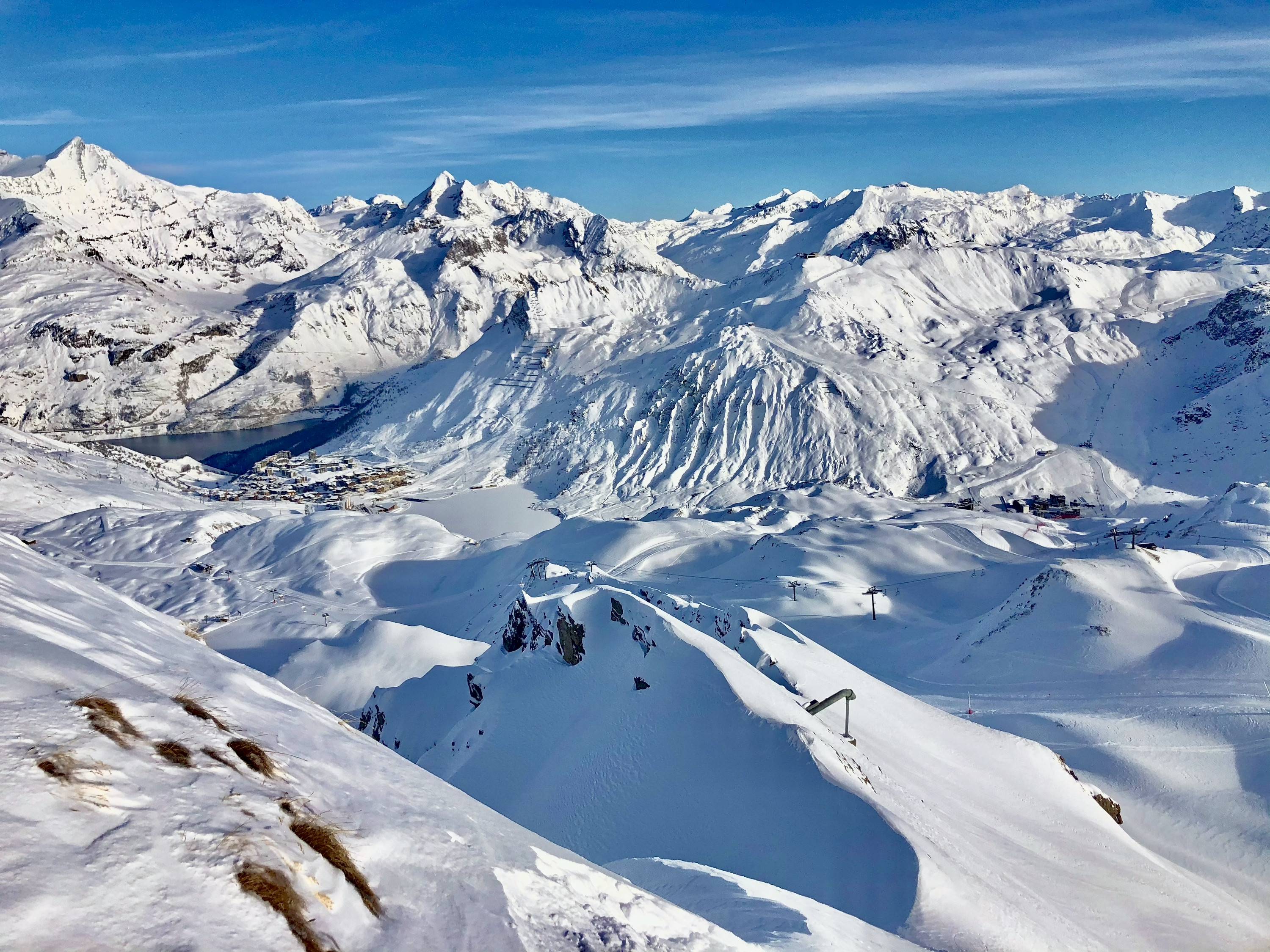
Tignes is a string of villages up a valley, each with its own altitude and its own way onto the hill, and knowing which one you're standing in is half of reading the Tignes trail map, as American visitors call it.
Les Brévières sits lowest, down around 1,550 m, a quiet old village with a lift back up into the system: charming, but the first snow to soften in a mild spell. Les Boisses / Tignes 1800 is the next rung, rebuilt with a gondola straight up to Tovière. Tignes le Lac and Val Claret are the two high hubs, both around 2,100 m on the shore of the reservoir, and between them they hold most of the beds and most of the direct access to the glacier. Base yourself in Val Claret and the Grande Motte funicular is a few minutes from your door.
Get the shape of the villages and the map falls into place.
Grande Motte: go high for snow that lasts
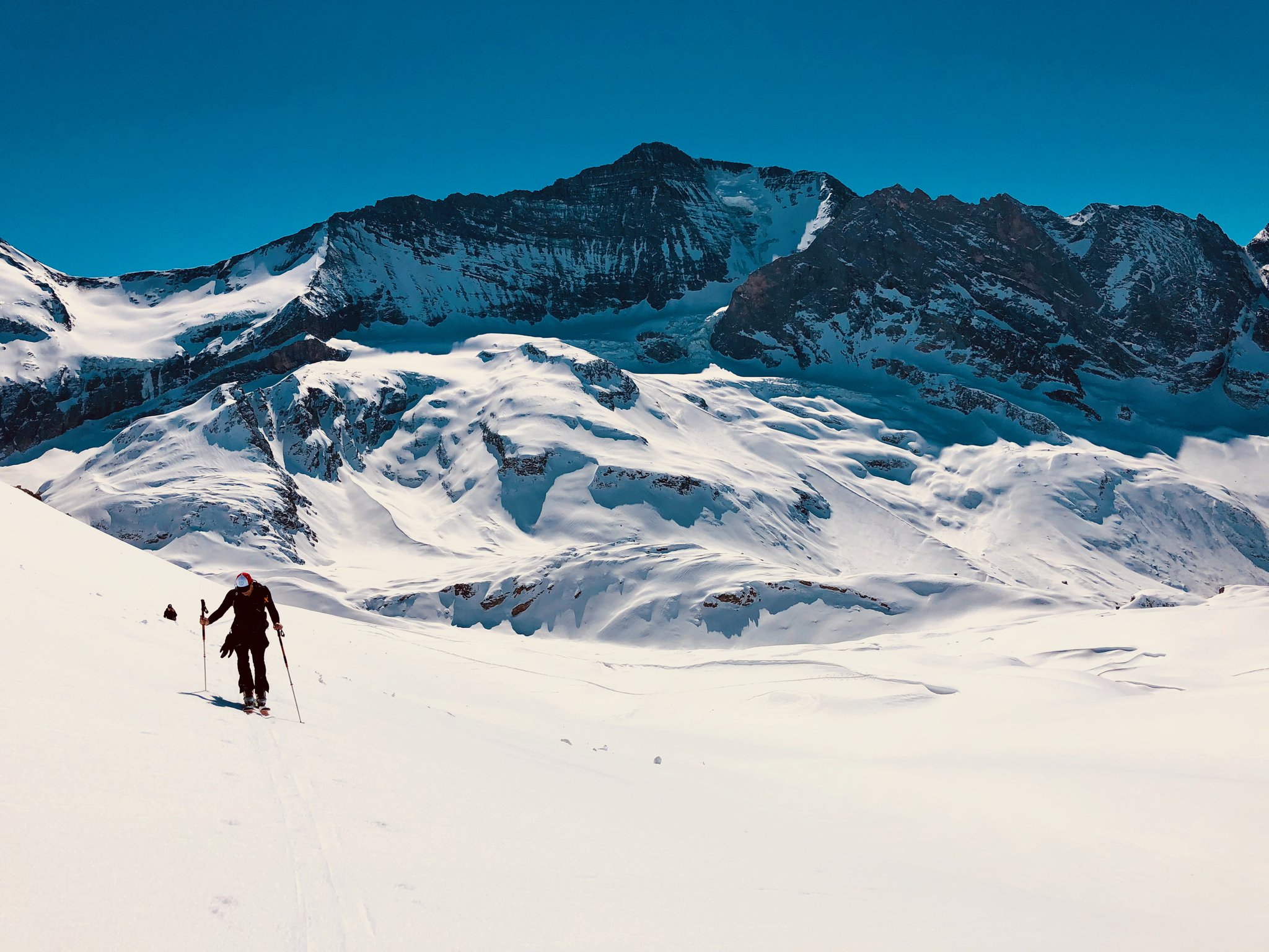
The Grande Motte is the reason you can ski in Tignes from autumn into late spring. The funicular climbs out of Val Claret into the mountain and the top lift station sits at 3,456 m, on the glacier below the 3,656 m summit. This is the cold, north-facing altitude that holds powder for days after it has gone heavy lower down.
On the map, the Grande Motte is the high white cap above Val Claret, fed by the funicular and a chain of runs back down. Read it as your snow insurance: on a warm week, head up onto the glacier in the morning, while the snow is still cold. The long blue back to Val Claret is a genuine pleasure, high-altitude cruising with the whole valley opening beneath you.
Val Claret: your base for the glacier
Val Claret is the highest of the villages and the natural base for anyone chasing snow. The Grande Motte funicular starts here, the Grattalu and Tichot lifts fan out above, and the runs home stay high enough to keep their surface into the afternoon.
On the piste map, Val Claret is your hinge point: from it you reach the glacier one way, Tovière and the Val d'Isère link the other, and the Palet sector round the back. It's also where a lot of the off-piste access sits, the bowls and shoulders that stay uncoloured on the sheet. The map takes you to the lift; where the good snow lies beyond it is the read we hand you.
Tovière: choose your afternoon, or cross to Val d'Isère
Tovière is the shoulder that ties the whole area together. The gondola from Le Lac and the one from Tignes 1800 both feed it, and from the top at roughly 2,700 m you can drop back into Tignes or slide over the Col de Fresse into Val d'Isère. It's the busiest crossroads on the mountain for a reason.
Read Tovière as a decision point. The runs off it face several ways, so it's often where you choose your afternoon by the light: sunny side early, shaded side when the sun swings round. And if you're heading over to ski Val d'Isère for the day, this is one of the two doors. Note the time of the last lift back before you cross. Our Val d'Isère ski map shows what waits on the other side, and the Espace Killy piste map puts both valleys on a single sheet.
Palet and Aiguille Percée: rack up the kilometres above Le Lac
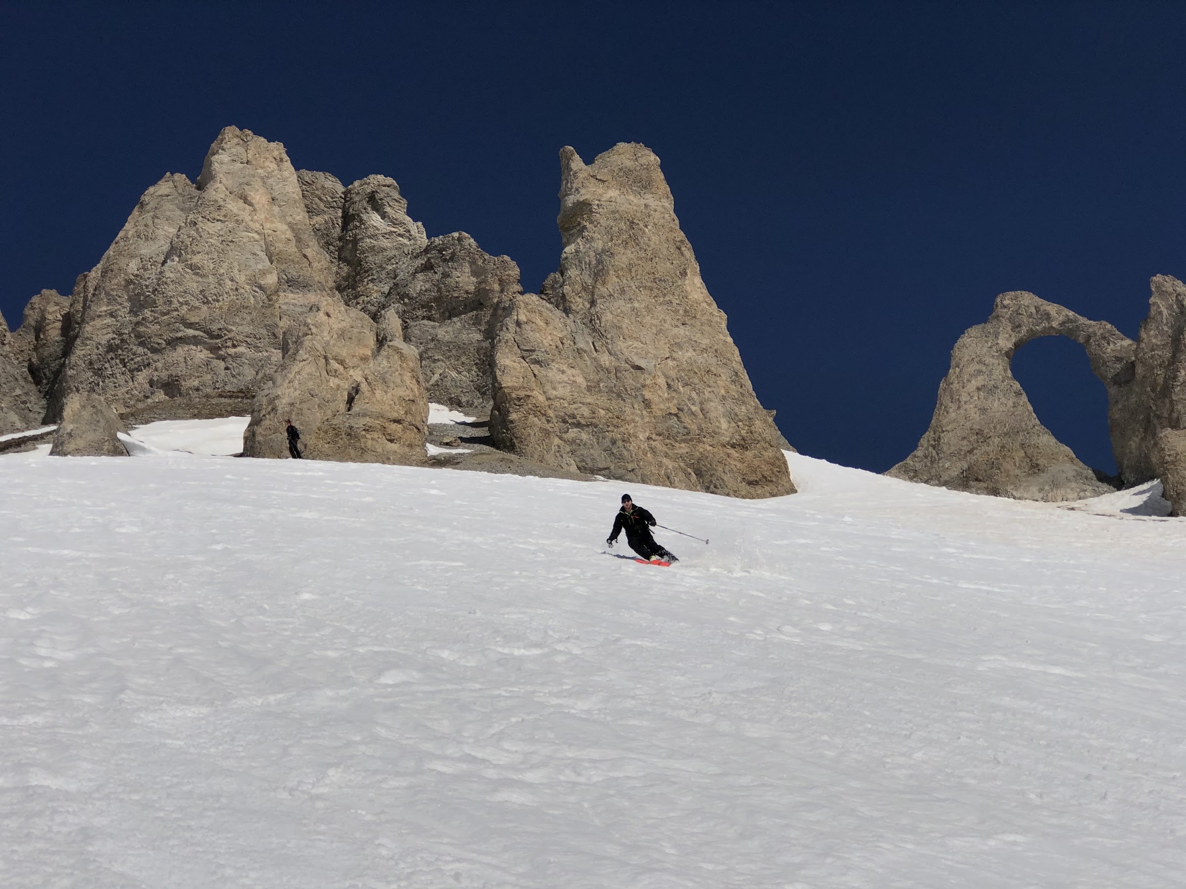
Above Tignes le Lac, the Palet and Aiguille Percée sectors give the area its gentler, more open character: rolling reds and blues, the famous pierced-rock landmark of the Aiguille Percée, and a long, scenic run down towards Les Brévières for anyone who wants distance under the skis.
On the map this is the eastern side of the bowl, away from the glacier. It's good intermediate ground and a fine place to cover distance, but read the run home carefully: the descent to Les Brévières is long and low, and in a mild spell the bottom softens by mid-afternoon. Know your last run before you commit to it.
Find your runs by level: beginner, intermediate, expert
Beginner (green and blue): stay high around Le Lac and Val Claret, where the snow is reliable and the gentle runs are grouped. The plateau lifts keep you clear of the fast through-traffic. Leave the long low run to Les Brévières until your legs are sure of themselves. With private ski tuition in Val d'Isère, your instructor can meet you in Tignes, at the same rate; a day of ski school in Tignes starts wherever suits you.
Intermediate (blue and red): the whole area opens up. Read the map by aspect, glacier and shaded runs when it's warm, sunny Tovière and Palet slopes when it's cold, and use Tovière to swing across to Val d'Isère for a change of scene.
Expert (red and black): the steep marked runs off the Grande Motte and Tovière are the warm-up. Beyond them the map thins fast, and that's the point: the couloirs and bowls that made Tignes a freeride name stay uncoloured, because they are unpatrolled. That's where you ski with one of us, picking the right aspect at the right time. We read that terrain together, in the avalanche bulletin and in the snow itself.
Ski beyond the edge of your piste map
On the Tignes sheet, the colours stop at a clear edge and the paper turns blank. Once Tignes has won you over, that blank is where you'll want to be.
Beyond that line lies the bowl under the Grande Motte that catches the light two hours after opening, when yesterday's snow is still cold. There's the shaded bowl off Tovière that holds powder three days after a fall, quietly overlooked. And there are the slopes where a wind slab can sit and let go, which only a trained eye picks out.
We read it on the ground, the morning's avalanche bulletin in hand. The off-piste around Tignes is some of the finest in the Alps, and it rewards an expert eye. You can ski it with us all season long: everyone carries an avalanche airbag pack, a transceiver, a shovel and a probe, and we turn back whenever the snow asks us to. When another valley has the better snow, our off-piste day trips in the Tarentaise take you to Sainte-Foy, La Rosière or Bonneval.
Ski the lines beyond the sheet: our off-piste skiing in the Tignes–Val d'Isère area
A word from the founder
We've been taking skiers round Tignes for more than twenty years, in every weather. Beyond the piste map, we show you where the good snow is on the day, and when the moment is right to commit to a line. Learn the sectors; the rest we'll find together.
Boris Malesset, founder, PowderWeGo, off-piste professional in Tignes and Val d'Isère since 2001
Everything coloured on this map is patrolled and controlled; the off-piste is open, natural mountain. Marked ski itineraries sit in between: signposted and open, but neither groomed nor patrolled continuously, and they lie outside the patrolled area. Step off a groomed, marked run and you're in avalanche terrain, where the risk exists even under a clear sky and a few metres from the piste, and the Grande Motte glacier adds crevasses of its own. Before anyone in our care leaves the marked runs, we go through Météo-France's bulletin (BRA) for Savoie, check the weather and recent wind, and make sure everyone carries an avalanche airbag pack, transceiver, shovel and probe, provided by us, and knows how to use them. We turn back whenever the mountain calls for it. Our off-piste and touring days are led by a qualified off-piste ski instructor or mountain guide, with a guide coming along on request for the rare route that requires one. On the marked area, respect closures and signage: each one is there for a reason.
FAQ
Where can I download the Tignes piste map?
Right here at the top of this page: the official Tignes piste map in HD, free, courtesy of the resort. Give us your first name, email and language and it lands in your inbox straight away, ready for your pocket and your phone. Below the map, we add our own sector-by-sector read, so you know where the snow sits and which sector suits the day before you unfold the sheet.
How big is the Tignes ski area, and how high does it go?
Tignes shares the linked Tignes–Val d'Isère area, around 300 km of pistes in total. The villages run from Les Brévières at roughly 1,550 m up to Val Claret at about 2,100 m, and the highest lift reaches 3,456 m on the Grande Motte glacier.
Is the Tignes map the same as the Val d'Isère map?
Yes. Tignes and Val d'Isère share one linked ski area, the old Espace Killy, so a single piste map covers both and one lift pass lets you ski across. The two crossings, over Tovière and the Col de Fresse or over the heights of Solaise, are marked on the sheet.
Which sectors of Tignes are best for beginners?
Stay high around Tignes le Lac and Val Claret, where the gentle green and blue runs are grouped and the snow is reliable at altitude. Leave the long, low run down to Les Brévières until you're skiing with confidence.
When is the Grande Motte glacier open?
The Grande Motte is the high, cold heart of Tignes and it skis for much of the year, but opening depends on the season and conditions. Check the resort's live lift status for the day. It's the first place to look for cold snow when the lower slopes are baking.
Does the piste map show the off-piste?
No. Off-piste terrain is neither patrolled nor graded, so it stays off a piste map. The bowls and couloirs around the Grande Motte and Tovière are exactly where guided skiing comes in, with someone who reads the snow and the avalanche bulletin before you drop in.