Espace Killy · Val d'Isère + Tignes
Espace Killy piste map: 300 km of skiing, from one valley to the other
One pass, two valleys, roughly 300 km of linked runs on a single HD sheet. Download the Espace Killy piste map here, then read on for how to use it well: where the two sides join, which valley to be in when, and where the good snow hides.
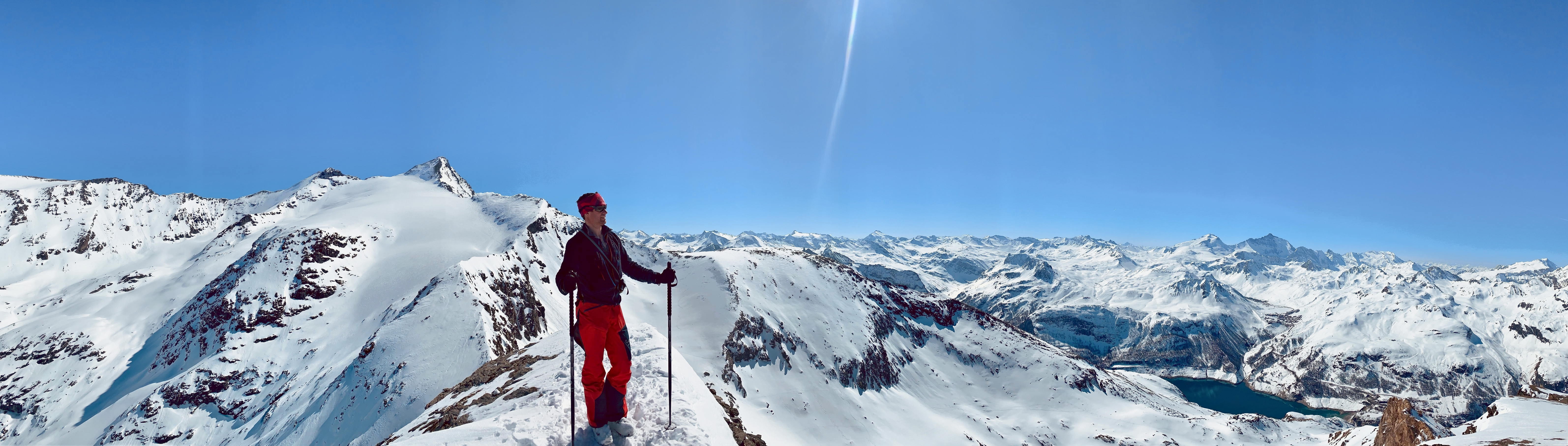
In brief
- Ski area
- Espace Killy, the linked Val d'Isère + Tignes area, around 300 km of pistes
- The two valleys
- Val d'Isère (~1,850 m town) and Tignes (villages from ~1,550 m to ~2,100 m)
- The joins
- Tovière and the Col de Fresse (Bellevarde side), and the heights of Solaise (Val d'Isère side)
- Highest lift
- Grande Motte glacier top station 3,456 m (Tignes side)
- Val d'Isère glacier
- Pissaillas, above Le Fornet, around 3,141 m
- One ticket
- a single lift pass covers both valleys
- The map
- the resorts' official Espace Killy sheet in HD, yours free from the form above
- Valley guide
- further down the page: which valley suits the day, and where the snow settles
One name, two valleys, one pass in your pocket
Espace Killy is the old name, and plenty of us still use it. The resorts now brand the combined area as Tignes–Val d'Isère, and the shape is the same as ever: two valleys, one lift pass, and around 300 km of pistes stitched together over the high ground between them. Named after Jean-Claude Killy, the Val d'Isère racer, it remains one of the great linked areas of the Alps.
What matters on the ground is that you can ski a full week and find something new each day, provided you know where the two sides join and when to cross. That's the whole trick of reading the Espace Killy piste map: the individual runs are clear enough; the art lies in the geography that links them, and in the timing.
The official map, the folded sheet, is the resorts' own document, and they have kindly let us offer it in HD from the form above; their official interactive versions are linked further down. What we add is how to use it: which valley holds the snow on a given day, and how to move between them and be back on the right side by last lift.
A quick word on the French colour code, which North American visitors read slightly differently. Greens are for first days on skis and blues for easy cruising; reds are where the gradient starts to bite, and blacks are steep in earnest. The French scale stops at black, and an Espace Killy black earns its grade on its own.
Cross from one valley to the other
Read the area as a figure of eight and it falls into place. In the middle, where the two loops meet, sits the high ground you cross to change valley.
Tovière is the main door. From the Tignes side, the gondolas from Le Lac and Tignes 1800 climb to Tovière at roughly 2,700 m, and from the top you slide down towards the Col de Fresse and into Val d'Isère under the Bellevarde sector. Coming the other way, you climb out of Val d'Isère over the same ground and drop into Tignes above Val Claret. It's the busiest crossing for good reason: it's the most direct.
The second join is quieter, over the heights of Solaise, further east on the Val d'Isère side, linking across the tops rather than through the middle. It's the scenic way over, and on a busy week it's the one that keeps you clear of the crowds at Tovière.
The rule that keeps the evening relaxed: before you cross, note the time of the last lift back to your own valley. Miss it, and the way home from Tignes to Val d'Isère, or the reverse, is a long, dear taxi ride round by road. It's the kind of mistake you make once.
Val d'Isère side: sunny mornings and high snow
Val d'Isère's own terrain has four sectors. Solaise, above the town, is the sunny, rounded sector of wide blues and greens, the place to find your legs. Bellevarde is the serious one, topping out at 2,827 m, home to the Face de Bellevarde, the Olympic downhill, and the start of most of the Val d'Isère off-piste. Le Fornet, at the valley's far end, is the high, quiet sector: its cable car climbs to the Pissaillas glacier around 3,141 m, the last snow to soften in spring. La Daille, where the road comes in from Bourg-Saint-Maurice, is the way in each morning and the way home each evening, down the OK, the World Cup run.
Read the Val d'Isère side as your sunny mornings and your high-altitude insurance. When the runs back to town wear thin in the afternoon, the Fornet and the shaded north faces off Bellevarde are where the snow keeps. More detail on all four: the Val d'Isère piste map, read the same way.
Tignes side: head up to the Grande Motte glacier
Tignes brings the altitude. The Grande Motte glacier, reached by funicular out of Val Claret, tops out at 3,456 m, the highest lift-served snow in the area and the reason the region skis so late. Val Claret and Tignes le Lac, both around 2,100 m, are the high hubs that feed it, and Tovière is the crossroads back towards Val d'Isère.
Read the Tignes side as your snow bank: on a warm week, this is where you go high and cold in the morning. The long blue off the Grande Motte back to Val Claret is high-altitude cruising at its best. The full breakdown: the Tignes piste map, sector by sector.
Ski the whole area in a single day
The classic Espace Killy day is a traverse: start high on your own side for the cold morning snow, cross at Tovière or over the Solaise tops around late morning, ski the far valley through the afternoon as the light and the snow suit, and time your run back to your own side before the last lift.
On the map, trace that line before you set off. It's a big day, and a satisfying one: two valleys, two characters, glacier snow at one end and Olympic pistes at the other. Ask us that morning and we'll tell you which way round to do it, depending on where the sun and the fresh snow have landed.
From first turns to the steeps: the area by level
Beginner (green and blue): stay on Solaise on the Val d'Isère side and high around Le Lac and Val Claret on the Tignes side, where the gentle runs are grouped and the snow is reliable. Keep the valley-linking reds and the long low returns for when your legs feel sure. If you'd like an instructor alongside, our ski lessons in Val d'Isère start from your very first turn.
Intermediate (blue and red): the whole 300 km is yours. Read the map by aspect and by valley, sunny side in the morning, shaded and glacier snow when it's warm, and use the joins to swing between the two for variety.
Expert (red and black): the Face de Bellevarde, the steep runs off the Grande Motte and Tovière, then the terrain that made the area's name. The bowls under Bellevarde, the couloirs off Val Claret, the high shoulders off the Pissaillas: all of it off the printed map, since it lies beyond the patrolled area. That's where you ski with us, reading the avalanche bulletin rather than the folded sheet.
Ski the vast blank beyond your piste map
Every piste map has a line where the colours stop. In an area this size, that blank space is vast, and the better you know the Espace Killy, the more of your days it will claim.
The best of it lives off the paper: the valley that caught the fresh snow overnight, the north-facing bowl still keeping its powder well after the last fall, away from the crowds, the morning when Tignes skis beautifully while Val d'Isère bakes in the sun, or the reverse. So does the knowledge of where a slope turns fragile and a wind slab lies in wait.
We work it out on the snow, valley to valley, with the morning's avalanche bulletin and many winters on both sides behind us. The Espace Killy holds some of the finest off-piste in the Alps, and every valley repays a close reading. Join us any week of the season: we bring the transceivers, shovels and probes, read the bulletin before the first lift, and turn back the moment the snow tells us to.
Find the lines beyond the map: our off-piste skiing across the area
A word from the founder
For more than twenty years we've been taking skiers across the Espace Killy and back, from the Pissaillas to the Grande Motte. We'll teach you to read the area as a single whole, and to sense when a slope is ready for you. Learn the geography, and we'll show you the rest on the snow.
Boris Malesset, founder, PowderWeGo, off-piste professional in Val d'Isère and Tignes since 2001
The pistes on this map belong to the patrolled, controlled ski area; the off-piste is natural mountain terrain. The marked ski itineraries are a case apart: signposted and open, though neither groomed nor patrolled throughout, and they lie beyond the patrolled area. Once you leave the groomed, marked runs you are in avalanche terrain, where the risk holds even in fine weather and a few metres from a piste, and the two glaciers add crevasses to the picture. Skiing off-piste means carrying a transceiver, shovel and probe and knowing how to use them, checking the Savoie avalanche bulletin every morning, and being ready to turn back. On our guided outings we provide the safety kit and make those calls with you, led by a qualified off-piste ski instructor, with a mountain guide joining on request whenever a route calls for one. On the marked area, follow the closures and signage: each one has its reason.
FAQ
What is the Espace Killy?
It's the old name for the linked Val d'Isère and Tignes ski area, around 300 km of pistes over two valleys, sharing one lift pass. The resorts now brand it as Tignes–Val d'Isère, but the area is the same and many skiers still call it the Espace Killy, after the Val d'Isère racer Jean-Claude Killy.
How do Val d'Isère and Tignes link up?
Over the high ground between them. The main crossing is Tovière and the Col de Fresse, under the Bellevarde sector; a quieter link runs over the heights of Solaise, further east. One lift pass covers both, and the crossing points are marked on the area map.
How big is the Espace Killy, and how high does it go?
Around 300 km of linked pistes. The Val d'Isère town sits at 1,850 m; on the Tignes side the lifts top out on the Grande Motte glacier at 3,456 m, and on the Val d'Isère side the Pissaillas glacier reaches around 3,141 m.
Do I need a separate lift pass for each valley?
No. A single Espace Killy / Tignes–Val d'Isère pass covers both valleys, so one ticket takes you across for the day. Just note the last lift back to your own valley before you cross.
Where can I download the Espace Killy piste map?
From the form at the top of this page: the official Espace Killy (Tignes–Val d'Isère) piste map in HD, free, courtesy of the resorts. Leave your first name, email and language and it reaches your inbox within moments. Below the map, we add our own read of the whole area: which valley holds the snow and how to plan your day across both.
Does the piste map show the off-piste?
No. Piste maps leave the off-piste blank, since it lies outside the patrolled, graded area. The bowls and couloirs on both sides are guided ground, best skied with someone who has read the snow and the morning bulletin first.